Title: Countryside
Description: SC 350 highway.
Local: Alfredo Wagner, Brazil
Date of Registration: 06/09/2010

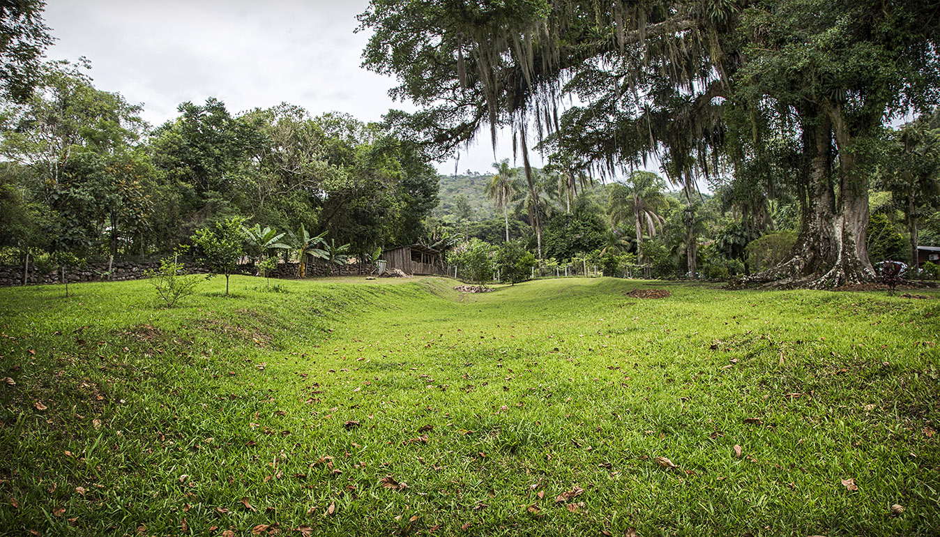
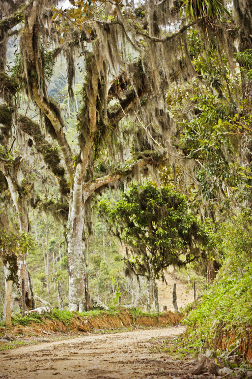
Title: Way of Troops
Description: Remaining stretch of an old road built by slaves connecting Desterro to Lages
Local: São Pedro de Alcântara, Brazil
Date of Registration: 12/02/2012

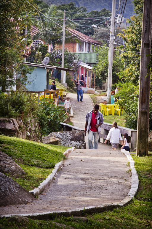
Title: Typical pedestrian street
Description: Costa da Lagoa neighborhood
Local: Florianópolis, Brazil
Date of Registration: 01/10/2011

Title: Dona Tereza Cristina railroad
Description: Situated in the locality of Cabeçuda, it was inaugurated in 1882, and was used to transport coal and passengers. It has been disabled in 1934 with the construction of a new bridge.
Local: Laguna, Brazil
Date of Registration: 08/02/2015

Title: Aspects of the region
Description: BR 282 highway
Local: Alfredo Wagner, Brazil
Date of Registration: 06/09/2010

Title: Cobble
Description: Tiradentes Street in the city centre.
Local: Florianópolis, Brazil
Date of Registration: 07/09/2010

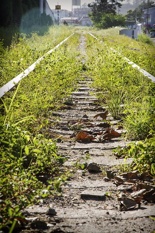
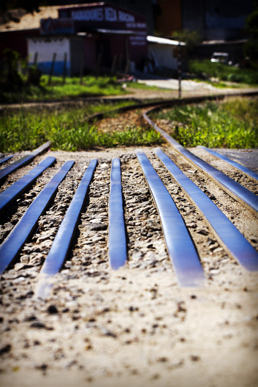
Title: The train tracks
Description: Located at the boundary between of the cities of Criciúma and Nova Veneza
Local: Criciúma, Brazil
Date of Registration: 13/08/2011

Title: Way of Troops
Description: Remaining stretch of an old road built by slaves connecting Desterro to Lages
Local: São Pedro de Alcântara, Brazil
Date of Registration: 12/02/2012

Title:
Description:
Local:
Date of Registration: 07/09/2013

Title: The boat and the anchorage
Description: Typical scene of Costa da Lagoa neighborhood
Local: Florianópolis, Brazil
Date of Registration: 01/10/2011

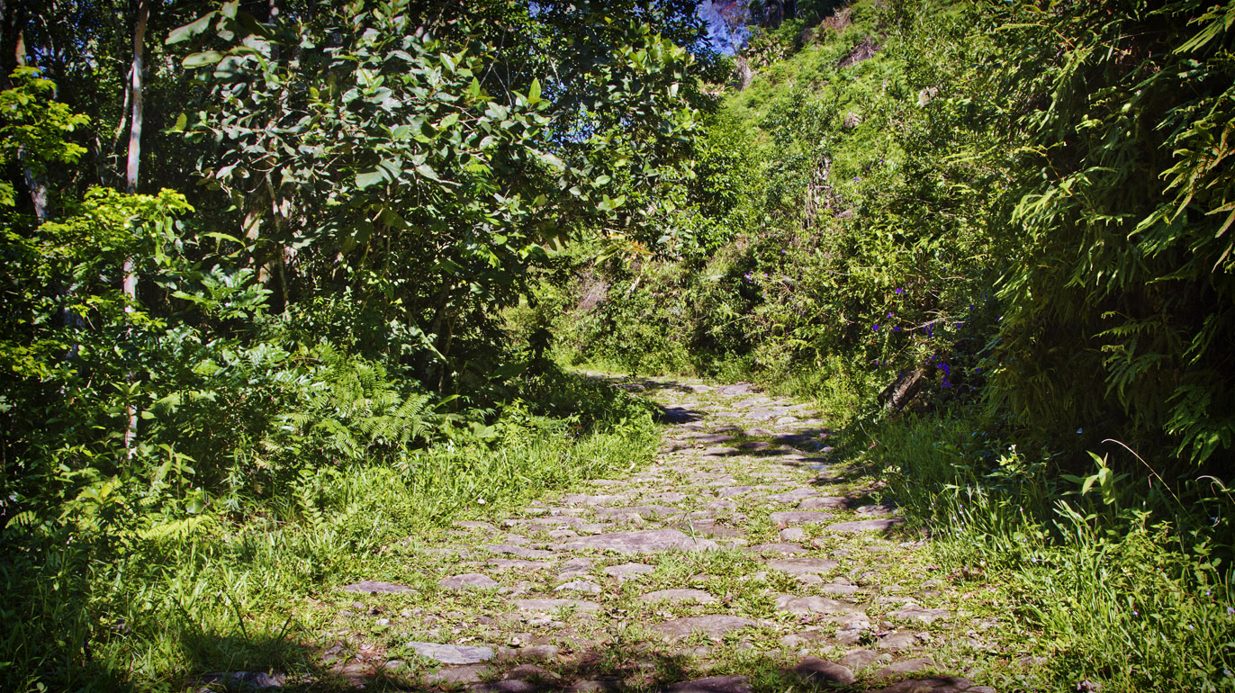
Title: Glade
Description: This galde is on Azambuja General road which connects the District of Azambuja with the centre of Pedras Grandes. At the end of the 19th century this road was the route used by Italian immigrants to reach the Colony of Azambuja.
Local: Azambuja, Pedras Grandes, Brazil
Date of Registration: 10/01/2017

Title: Path of the troops
Description: Remaining path of the troops in the locality of Pericó
Local: São Joaquim, Brazil
Date of Registration: 08/10/2013

Title: Way of Troops
Description: Remaining stretch of an old road built by slaves connecting Desterro to Lages
Local: São Pedro de Alcântara, Brazil
Date of Registration: 12/02/2012

Title: Detail of stones of the steps of the main access door to the Hotel
Description: Caldas da Imperatriz Hotel.
Local: Santo Amaro da Imperatriz, Brazil
Date of Registration: 28/09/2017

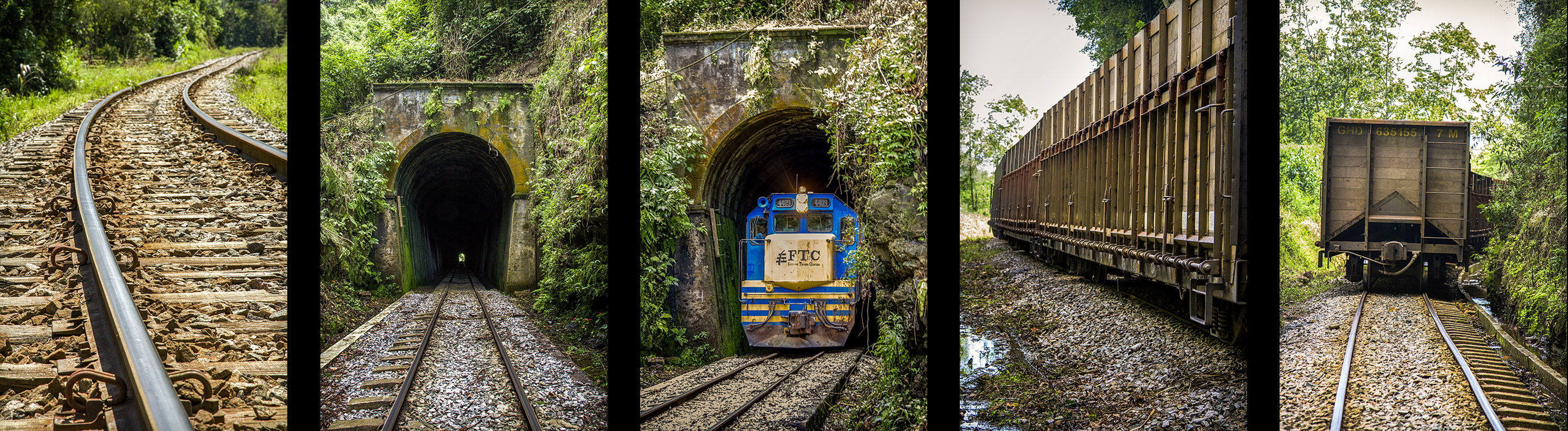
Title: Tunnel
Description: It has 388,45 meters of extension and its construction took two years. It was inaugurated in 1944 to make possible the route of the trains of the Railroad Tereza Cristina. It is located under a hill between the neighborhoods of Santa Luzia and Ex-Patrimônio. It is currently still used for coal rail transport.
Local: Siderópolis, Brazil
Date of Registration: 07/03/2013

Title: Curves of the Tereza Cristina railroad
Description: Located at São Pedro neighborhood next to SC 445 highway.
Local: Urussanga, Brazil
Date of Registration: 10/01/2017

Title: Street of the Historical Centre
Description: Note that there is a train crossing the street
Local: São Francisco do Sul, Brazil
Date of Registration: 08/09/2012

Title: Aspects of the region
Description: BR 282 highway
Local: Alfredo Wagner, Brazil
Date of Registration: 06/09/2010

Title: Way of Troops
Description: Remaining stretch of an old road built by slaves connecting Desterro to Lages
Local: São Pedro de Alcântara, Brazil
Date of Registration: 12/02/2012

Title: Interior of a coal mine
Description: Octávio Fontana Visitation Mine
Local: Criciúma, Brazil
Date of Registration: 09/11/2013

Title: Plates of the way to Costa da Lagoa
Description: Costa da Lagoa neighborhood
Local: Florianópolis, Brazil
Date of Registration: 01/10/2011

Title: Way of Troops
Description: Remaining stretch of an old road built by slaves connecting Desterro to Lages
Local: São Pedro de Alcântara, Brazil
Date of Registration: 12/02/2012

Title: Stone floor of the Museum
Description: Anita's House Museum is located in the Historical Center in a house built in 1711. This Museum contains objects and utensils that resemble the trajectory of Anita Garibaldi (1821-1849) and her romance with Giuseppe Garibaldi. It was in this house that Anita dressed for her first wedding in 1835, with the shoemaker Manuel Duarte Aguiar.
Local: Laguna, Brazil
Date of Registration: 12/08/2012

Title: Main avenue of the Azambuja District
Description: Located in the Historical Centre in front of St. Mark`s Church. It is the sequence of the road of 11 km that connects Azambuja District with the center of Pedras Grandes. At the end of the 19th century this road was the route used by Italian immigrants to reach the Colony of Azambuja.
Local: Azambuja, Pedras Grandes, Brazil
Date of Registration: 22/12/2016

Title: St. Mark`s Church
Description: Located on a hill in the Historic Center of the District of Azambuja. It has an architectural style of great historical-cultural value and is part of the municipal public patrimony.
Local: Azambuja, Pedras Grandes, Brazil
Date of Registration: 24/11/2016

Title: View of the Getúlio Vargas Avenue
Description: Getúlio Vargas Avenue is located in the city center of Criciúma
Local: Criciúma, Brazil
Date of Registration: 10/11/2013

Title: Steps
Description: Located in front of the Caldas da Imperatriz Hotel.
Local: Santo Amaro da Imperatriz, Brazil
Date of Registration: 29/09/2017

Title: Typical landscape of the region
Description: São Bento Alto region.
Local: Nova Veneza, Brazil
Date of Registration: 13/01/2017

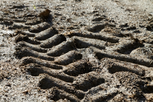
Title: Marks of a pathway used by immigrants in the route until their colonies during the colonization of south of Santa Catarina period
Description: It is located in private property of Iris Cancelier family in Rio Maior neighborhood.
Local: Urussanga, Brazil
Date of Registration: 25/11/2016

Title:
Description:
Local:
Date of Registration: 03/09/2013

Title: SC 447 highway
Description: Arriving to Treviso city.
Local: Treviso, Brazil
Date of Registration: 13/01/2017

Title:
Description:
Local: Águas Mornas, Brazil
Date of Registration: 20/02/2011

Title: Pathway
Description: Stone house built by Family Bratti, 1891.
Local: Nova Veneza, Brazil
Date of Registration: 13/08/2011

Title: Aspects of the region
Description: BR 282 highway.
Local: Alfredo Wagner, Brazil
Date of Registration: 06/09/2010

Title:
Description: SC 390 highway.
Local: Pedras Grandes, Brazil
Date of Registration: 26/12/2016

Title: Dry leaves on the avenue
Description: Getúlio Vargas Avenue is located in the city center of Criciúma
Local: Criciúma, Brazil
Date of Registration: 10/11/2013

Title: Paths and steps of stones
Description: Surroundings of Caldas da Imperatriz Hotel.
Local: Santo Amaro da Imperatriz, Brazil
Date of Registration: 28/09/2017

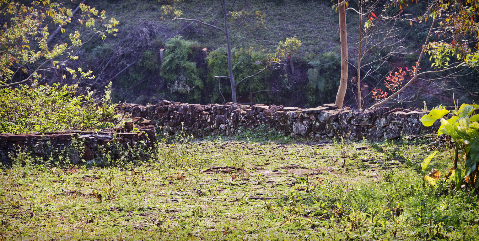
Title: Stone wall called taipas
Description: Stone house built by Family Bratti, 1891.
Local: Nova Veneza, Brazil
Date of Registration: 13/08/2011

Title: View of the access to the Antonieta de Barros Tunnel
Description: Governador Aderbal Ramos da Silva Avenue in the Saco dos Limões neighborhood region
Local: Florianópolis, Brazil
Date of Registration: 29/08/2010

Title: Interior of a coal mine
Description: Octávio Fontana Visitation Mine
Local: Criciúma, Brazil
Date of Registration: 09/11/2013

Title: Boat crossing Conceição Lagoon
Description: Costa da Lagoa neighborhood
Local: Florianópolis, Brazil
Date of Registration: 01/10/2011

Title: The train tracks
Description: Located at the boundary between of the cities of Criciúma and Nova Veneza
Local: Criciúma, Brazil
Date of Registration: 23/12/2012

Title: Scenarios of the region
Description: Way of Troops
Local: São Pedro de Alcântara, Brazil
Date of Registration: 23/10/2010

Title: Main entrance
Description: São José da Ponta Grossa Fort. The fortress began to be built in 1740, working as one of the vertices of the triangular defense North system of the Island of Santa Catarina.
Local: Florianópolis, Brazil
Date of Registration: 29/08/2010

Title: Aspects of the region
Description: BR 282 highway.
Local: Alfredo Wagner, Brazil
Date of Registration: 06/09/2010

Title: Scenes of the South of Santa Catarina Island
Description: Ribeirão da Ilha Neighborhood
Local: Florianópolis, Brazil
Date of Registration: 04/11/2012

Title: Apple plantation
Description: Ipê Farm
Local: São Joaquim, Brazil
Date of Registration: 06/04/2012

Title:
Description:
Local:
Date of Registration: 07/09/2013

Title: Way of Troops
Description: Remaining stretch of an old road built by slaves connecting Desterro to Lages
Local: São Pedro de Alcântara, Brazil
Date of Registration: 12/02/2012

Title: Way of Troops
Description: Remaining stretch of an old road built by slaves connecting Desterro to Lages
Local: São Pedro de Alcântara, Brazil
Date of Registration: 12/02/2012