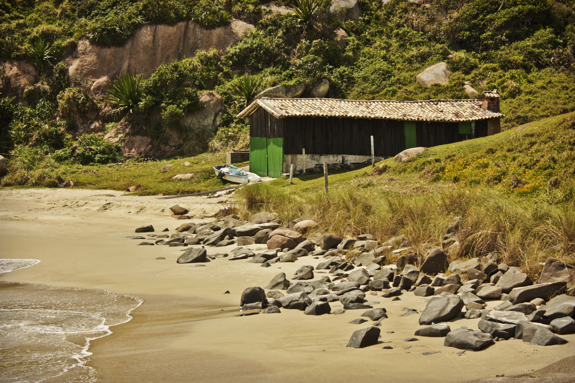
Title: Parcial view of Prainha do Farol
Description: Locality of Santa Marta Lighthouse.
Local: Laguna, Brazil
Date of Registration: 23/01/2015

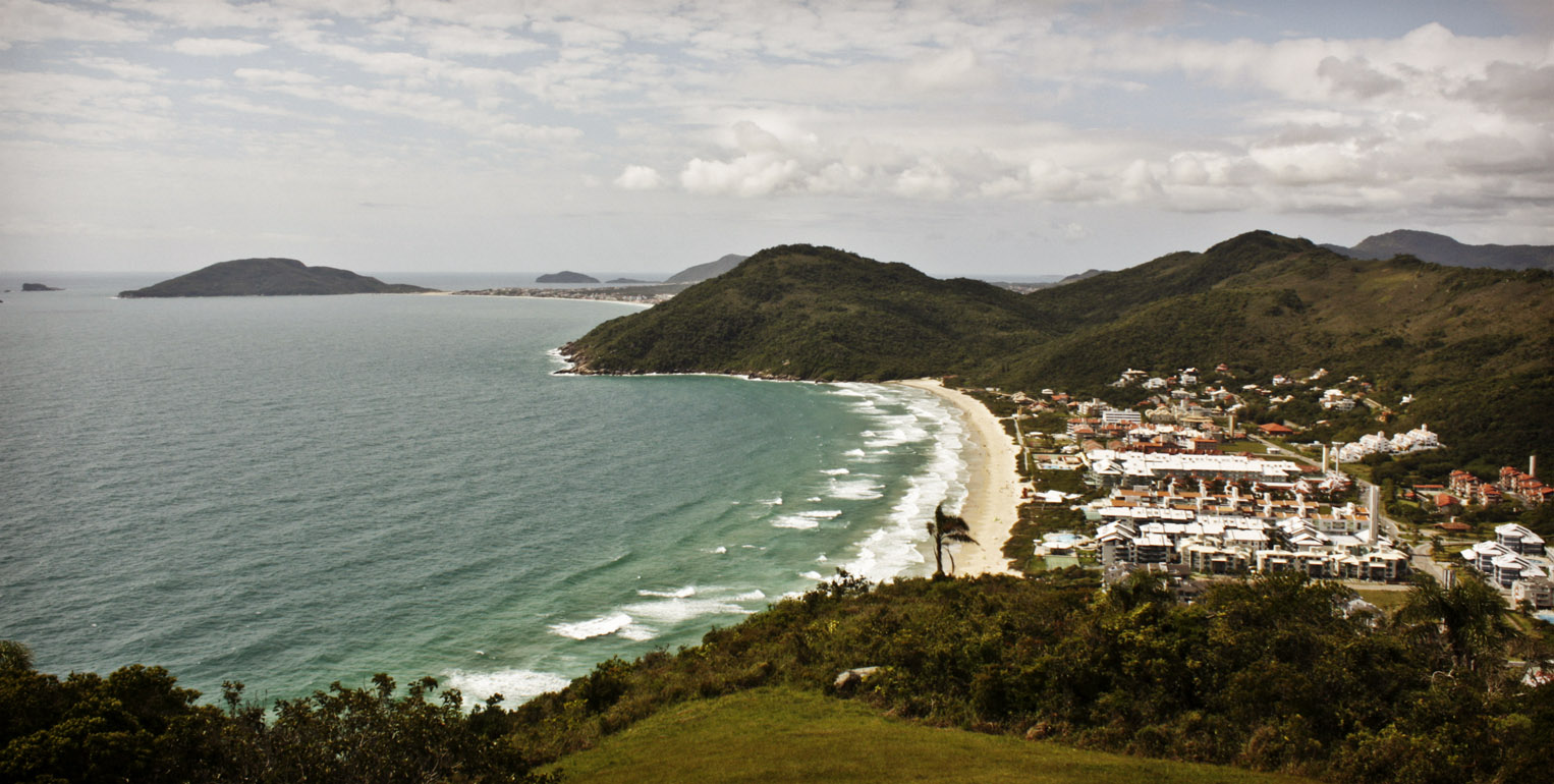
Title: Morro dos Conventos
Description: Aspects of Morro dos Conventos beach. From left to right: Araranguá lighthouse inaugurated in 1953, panoramic view of the beach and typical vegetation of the region.
Local: Araranguá, Brazil
Date of Registration: 22/04/2011

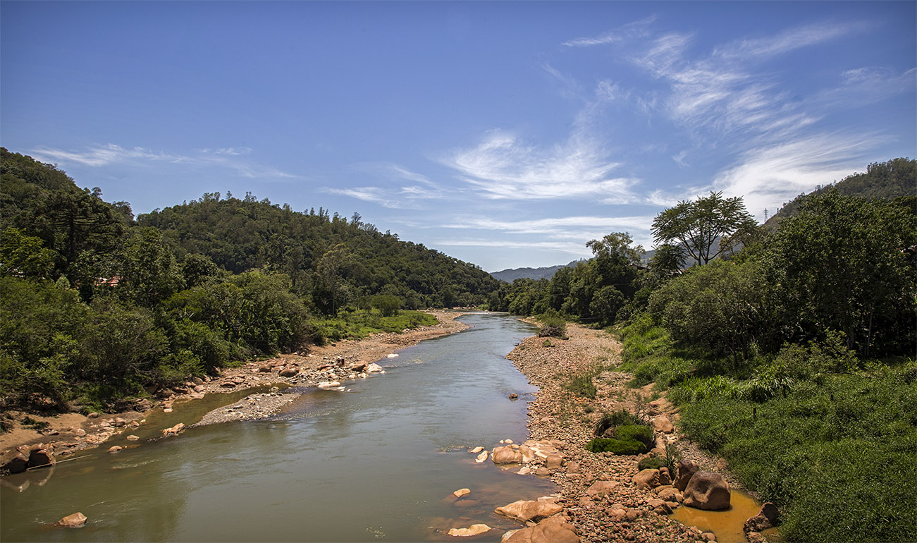
Title: Tubarão river
Description: During the colonization period south of Santa Catarina, the pathway near the Tubarão river that was already used by the muleteers that traveled between Laguna and mountains, also began to be used by the Italian immigrants for the travel towards the colonies. Currently this route coincides largely with parts of the SC 390 highway.
Local: Orleans, Brazil
Date of Registration: 26/12/2016

Title: Sunset in São Joaquim city
Description:
Local: São Joaquim, Brazil
Date of Registration: 06/04/2012

Title: Gi beach
Description: Gi beach seen from Laguna Tourist Hotel.
Local: Laguna, Brazil
Date of Registration: 03/11/2006

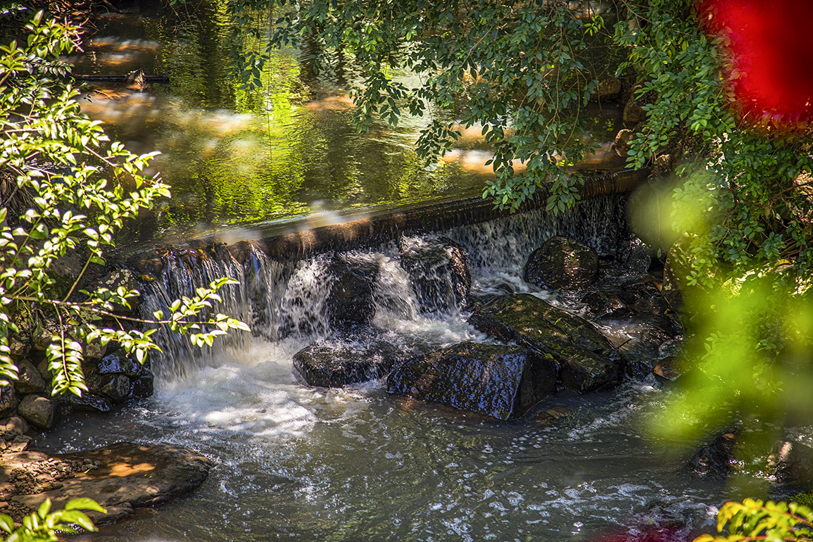
Title: Salto waterfall
Description: City centre
Local: São Pedro de Alcântara, Brazil
Date of Registration: 25/11/2012

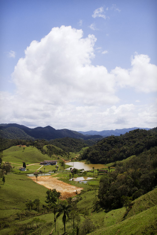
Title: Mountains of the region
Description: Mountains of Santa Catarina State.
Local: Alfredo Wagner, Brazil
Date of Registration: 06/09/2010

Title: Fig tree
Description: This secular fig tree that is regarded as a symbol by the locals. It would have been planted by immigrant colonists and served as a place of rest and shelter during extreme weather conditions. It is located in private property of Iris Cancelier family in Rio Maior neighborhood, next to an old road that was used by the Italian immigrants in the route until their colonies during the colonization of south of Santa Catarina period.
Local: Urussanga, Brazil
Date of Registration: 25/11/2016

Title: Typical landscape of the region
Description: The city is located near the Serra Geral.
Local: Treviso, Brazil
Date of Registration: 13/01/2017

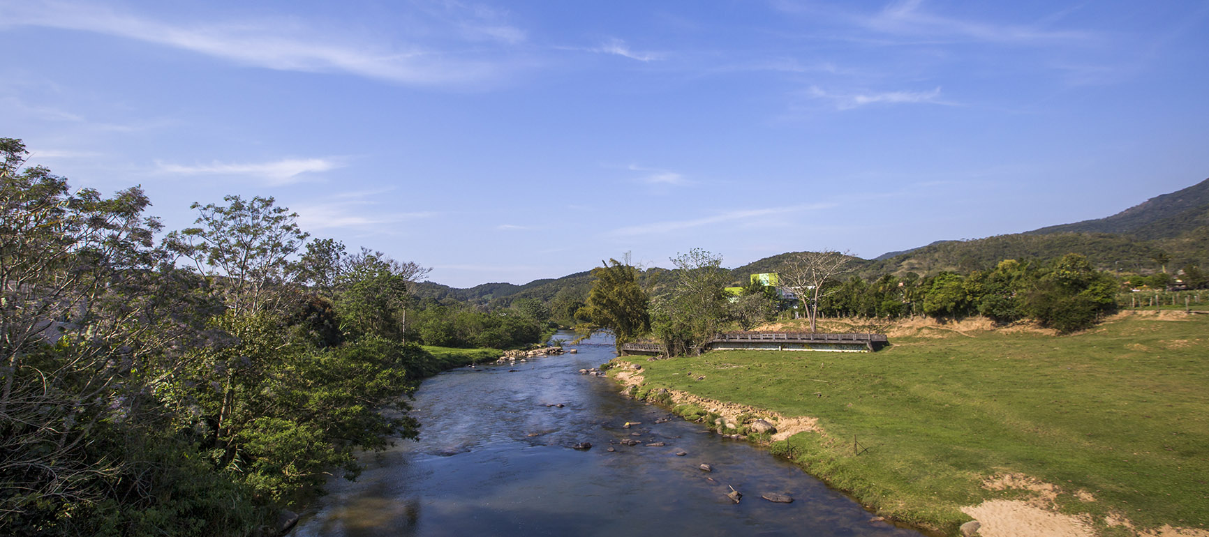
Title: Tubarão river
Description: Rural region of the city.
Local: Pedras Grandes, Brazil
Date of Registration: 26/12/2016

Title: Fisher
Description: Fishing in wier located in a place called São Bento Alto, in the locality of Balneário Rio São Bento.
Local: Nova Veneza, Brazil
Date of Registration: 21/08/2010

Title: Conventos Hill
Description: At the top of the hill there is a lighthouse and below is Araranguá River.
Local: Araranguá, Brazil
Date of Registration: 12/01/2017

Title: Beautiful scenery
Description: Typical landscape of the region
Local: São Pedro de Alcântara, Brazil
Date of Registration: 22/10/2011

Title: Mountains of the region
Description: Mountains of Santa Catarina State.
Local: Alfredo Wagner, Brazil
Date of Registration: 06/09/2010

Title: Mountains of the region
Description: Mountains of Santa Catarina.
Local: Alfredo Wagner, Brazil
Date of Registration: 06/09/2010

Title: Stones of Gravatá beach
Description: These stones are part of a lytic station.
Local: Florianópolis, Brazil
Date of Registration: 13/11/2010

Title: Landscape
Description: River in the city centre.
Local: Alfredo Wagner, Brazil
Date of Registration: 06/09/2010

Title: Dorigon Mountain
Description: Mountains of Santa Catarina highlands.
Local: Alfredo Wagner, Brazil
Date of Registration: 06/09/2010

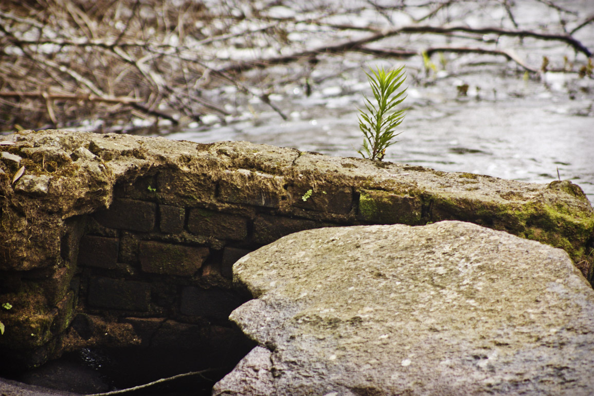
Title: Bridge over Caipora river
Description: This bridge was built by Germano Bez Fontana, on private land, using stones and concrete. It has three spans that were built in: 1943, 1961 and 2003.
Local: Treze de Maio, Brazil
Date of Registration: 11/01/2017

Title: Landscape
Description: Typical landscape of the Santa Catarina mountains. The properties are separated by taipas (stone walls)
Local: São Joaquim, Brazil
Date of Registration: 07/04/2012

Title: Mãe Luzia River in city centre (upstream)
Description: This river belongs to the watershed of the Araranguá river, and has its name referenced to a lady named (mother) Luzia, who washed clothes in the waters near the city of Nova Veneza. Unfortunately the river still suffers from pollution problems due to releases of tailings from coal mining in the region.
Local: Nova Veneza, Brazil
Date of Registration: 17/05/2014

Title: House of the Felder Family with a view of the flock of sheep
Description: House built of Araucaria angustifolia wood by Fidel Felder in 1942
Local: Treze Tílias, Brazil
Date of Registration: 11/10/2013

Title: Gravatá beach
Description:
Local: Florianópolis, Brazil
Date of Registration: 13/11/2010

Title: Landscape
Description: Typical landscape of the Santa Catarina mountains
Local: São Joaquim, Brazil
Date of Registration: 06/04/2012

Title: Typical rural landscape
Description: Next to Salto waterfalls
Local: São Pedro de Alcântara, Brazil
Date of Registration: 12/02/2012

Title: Furnas
Description: Located next to BR 101 highway, these furnas are caves that in the past were shelters of Indians. The largest of them is 17 meters wide. Between the 1940s and 1950s they were places where the mooliters stopped. They are now visited by tourists who appreciate their beauties and also use them as a place of devotion and faith.
Local: Sombrio, Brazil
Date of Registration: 23/12/2015

Title: Princess Isabel Open-Air Museum
Description: This museum is the first of its kind in Latin America. It was inaugurated on August 30, 1980 in an area of 20 thousand square meters. It has collections and environments that refer to the way of life of the Italian immigrants who colonized the south of Santa Catarina at the end of the 19th century.
Local: Orleans, Brazil
Date of Registration: 01/03/2012

Title: Encruzilhada
Description: From above Encruzilhada bridge it is possible to observe the exact point of confluence of the waters (forming a "Y") of the Trinta river.
Local: Arroio Trinta, Brazil
Date of Registration: 29/10/2016

Title: Panoramic view of Brava beach
Description: View from the ramp jump gliding
Local: Florianópolis, Brazil
Date of Registration: 15/11/2010

Title: Future of a past tense
Description: Loneliness Araucaria and a remaining part of the Troops pathway
Local: Bom Jardim da Serra, Brazil
Date of Registration: 07/04/2012

Title: Sand dunes
Description: Dunes located near to Santa Marta Lighthouse .
Local: Laguna, Brazil
Date of Registration: 23/01/2015

Title: First settlement of Italian immigrants
Description: At this exact place there was the first settlement of Italian immigrants who arrived at the Colony of Azambuja.
Location of this image was made by personal orientation of Mr. Eusébio Pasini Tonetto, Turismologist and Writer.
Research Source: TONETTO, E. P.; GHIZZO, I.; PIROLA, L. "Colônia Azambuja: a imigração italiana no sul de Santa Catarina". Florianópolis: EPAGRI, 2015, 211p.
Local: Azambuja, Pedras Grandes, Brazil
Date of Registration: 10/01/2017

Title: Sunset in São Joaquim city
Description:
Local: São Joaquim, Brazil
Date of Registration: 21/10/2012

Title: Tubarão river
Description: Rural region of the city.
Local: Pedras Grandes, Brazil
Date of Registration: 26/12/2016

Title: Gi beach
Description: View from the Friar Stone. It has 6 km long.
Local: Laguna, Brazil
Date of Registration: 11/11/2014

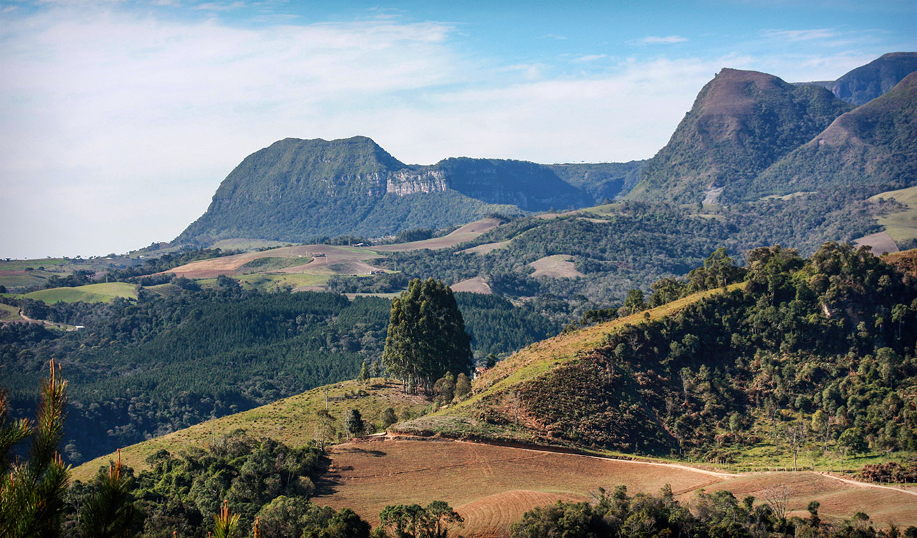
Title: Landscape of the mountains
Description: Typical landscape of the Santa Catarina mountains
Local: São Joaquim, Brazil
Date of Registration: 07/04/2012

Title: Landscape
Description: Typical landscape of the Santa Catarina mountains
Local: São Joaquim, Brazil
Date of Registration: 05/04/2012

Title: Bridge over Tubarão river
Description: City centre.
Local: Pedras Grandes, Brazil
Date of Registration: 22/12/2016

Title: Tubarão river
Description: Next to the city centre.
Local: Pedras Grandes, Brazil
Date of Registration: 26/12/2016

Title: Tree in a rice plantation
Description: Rural area of the city.
Local: Treze de Maio, Brazil
Date of Registration: 11/01/2017

Title: Aspects of Prainha do Farol
Description: Locality of Santa Marta Lighthouse.
Local: Laguna, Brazil
Date of Registration: 23/01/2015

Title: Geral Mountains
Description: View of the Geral Mountains from the city of Criciúma, with the newly installed aerogenerators
Local: Criciúma, Brazil
Date of Registration: 05/08/2013

Title: Parcial view of Prainha do Farol
Description: Locality of Santa Marta Lighthouse.
Local: Laguna, Brazil
Date of Registration: 23/01/2015

Title: Rio do Rastro mountain range
Description: In the extension of SC 390 highway between the cities of Lauro Müller and Bom Jardim da Serra there is the interconnection of the coastal region and the plains of the south of the State with the plateau of Santa Catarina. There are 15 kilometers of concrete road excavated in natural rock by a canyon of 1460 meters high. The history of this road began as of 1870 with the passage of muleteers mounted on mules and horses that made exchange between products of the mountain region and the coast.
Local: Lauro Müller, Brazil
Date of Registration: 21/10/2012

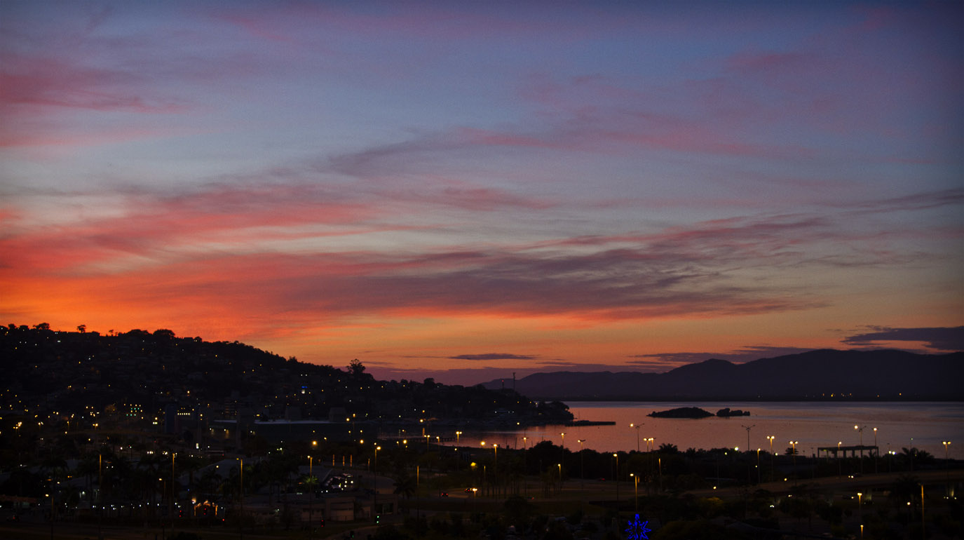
Title: Dawn
Description: Downtown area.
Local: Florianópolis, Brazil
Date of Registration: 07/01/2013

Title: Dorigon Mountain
Description: Mountains of Santa Catarina highlands.
Local: Alfredo Wagner, Brazil
Date of Registration: 06/09/2010

Title: Tubarão river
Description: During the colonization period south of Santa Catarina, the pathway near the Tubarão river that was already used by the muleteers that traveled between Laguna and mountains, also began to be used by the Italian immigrants for the travel towards the colonies. Currently this route coincides largely with parts of the SC 390 highway.
Local: Orleans, Brazil
Date of Registration: 26/12/2016

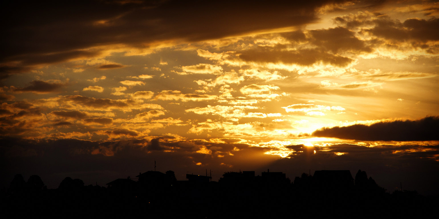
Title: Sunset in São Joaquim city
Description:
Local: São Joaquim, Brazil
Date of Registration: 21/10/2012

Title: View of Mar Grosso beach from the place where are the ruins of the Atalaia Fort
Description: Atalaia Fort ruins are situated in the locality of Ponta da Barra, it was built in 1800. In the battle of November 15, 1839 the revolutionaries occupied the site that was a strategic point. There they installed their artillery and used it as ammunition depot. At that time Anita Garibaldi once again demonstrated her warrior worth crossing the Barra Channel numerous times, taking in a small rowboat ammunition and weapons during a full shooting. With the defeat of farroupilhas forces and the occupation of the Imperial forces later, the Imperial Army has improved the building damaged in the fighting and used it for many years until disable it in the late nineteenth century. In 1992 the remaining ruins were listed as historic archaeological site by IPHAN (National Institute of Historical and Artistic Heritage), a 140 m² located in private property. This fort was also known as Laguna Fort, Barra small Fort, Atalaia small Fort, or Barra Fortress.
Local: Laguna, Brazil
Date of Registration: 07/02/2015


Title: Bridge over Caipora river
Description: This bridge was built by Germano Bez Fontana, on private land, using stones and concrete. It has three spans that were built in: 1943, 1961 and 2003.
Local: Treze de Maio, Brazil
Date of Registration: 11/01/2017

Title: Panoramic view of Gravatá beach
Description:
Local: Florianópolis, Brazil
Date of Registration: 13/11/2010

Title: Mountains of the region
Description:
Local: Alfredo Wagner, Brazil
Date of Registration: 06/09/2010

Title: Maior river
Description: Private property of Iris Cancelier family, Rio Maior neighborhood.
Local: Urussanga, Brazil
Date of Registration: 25/11/2016

Title: Typical landscape of the region
Description: São Bento Alto region.
Local: Nova Veneza, Brazil
Date of Registration: 13/01/2017

Title: Araranguá River
Description: In the background the city of Araranguá.
Local: Araranguá, Brazil
Date of Registration: 12/01/2017

Title: Landscape aspects
Description: Typical landscape of the Santa Catarina mountains. SC 430 highway
Local: São Joaquim, Brazil
Date of Registration: 03/11/2010

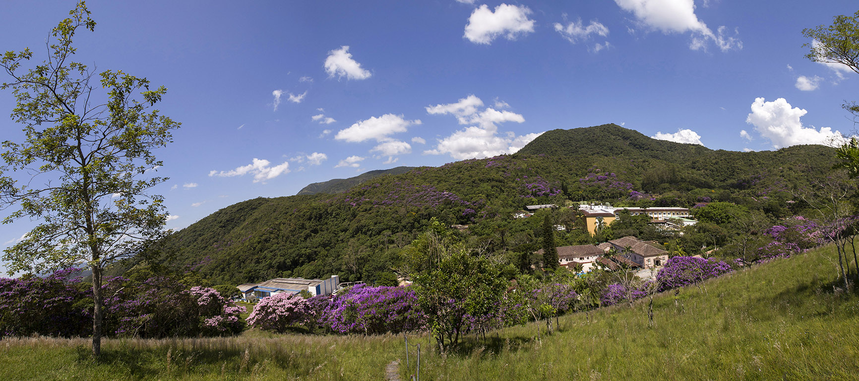
Title: Panoramic view of Caldas da Imperatriz
Description: Tabuleiro highlands.
Local: Santo Amaro da Imperatriz, Brazil
Date of Registration: 08/02/2018

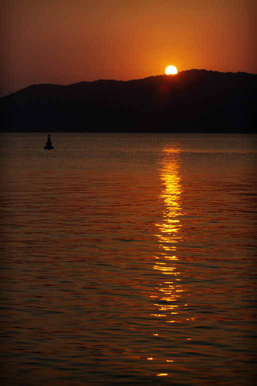
Title: Sunset
Description: Sunset on the Babitonga Bay
Local: São Francisco do Sul, Brazil
Date of Registration: 07/09/2012

Title: Rocky shore of Mole beach
Description: Rocky shore which also serves as an alternative path to Gravatá beach
Local: Florianópolis, Brazil
Date of Registration: 13/11/2010

Title: Azambuja river
Description: Near Azambuja District.
Local: Azambuja, Pedras Grandes, Brazil
Date of Registration: 24/11/2016

Title: Sand dunes
Description: Dunes located near to Santa Marta Lighthouse .
Local: Laguna, Brazil
Date of Registration: 23/01/2015

Title: Scenarios of the region
Description: Countryside
Local: São Pedro de Alcântara, Brazil
Date of Registration: 07/08/2011

Title: Corn plantation
Description: Rural area of the city.
Local: Treze de Maio, Brazil
Date of Registration: 11/01/2017

Title: Fishing
Description: Babitonga Bay at dusk
Local: São Francisco do Sul, Brazil
Date of Registration: 07/09/2012

Title: Salto waterfall
Description: City centre
Local: São Pedro de Alcântara, Brazil
Date of Registration: 23/10/2010

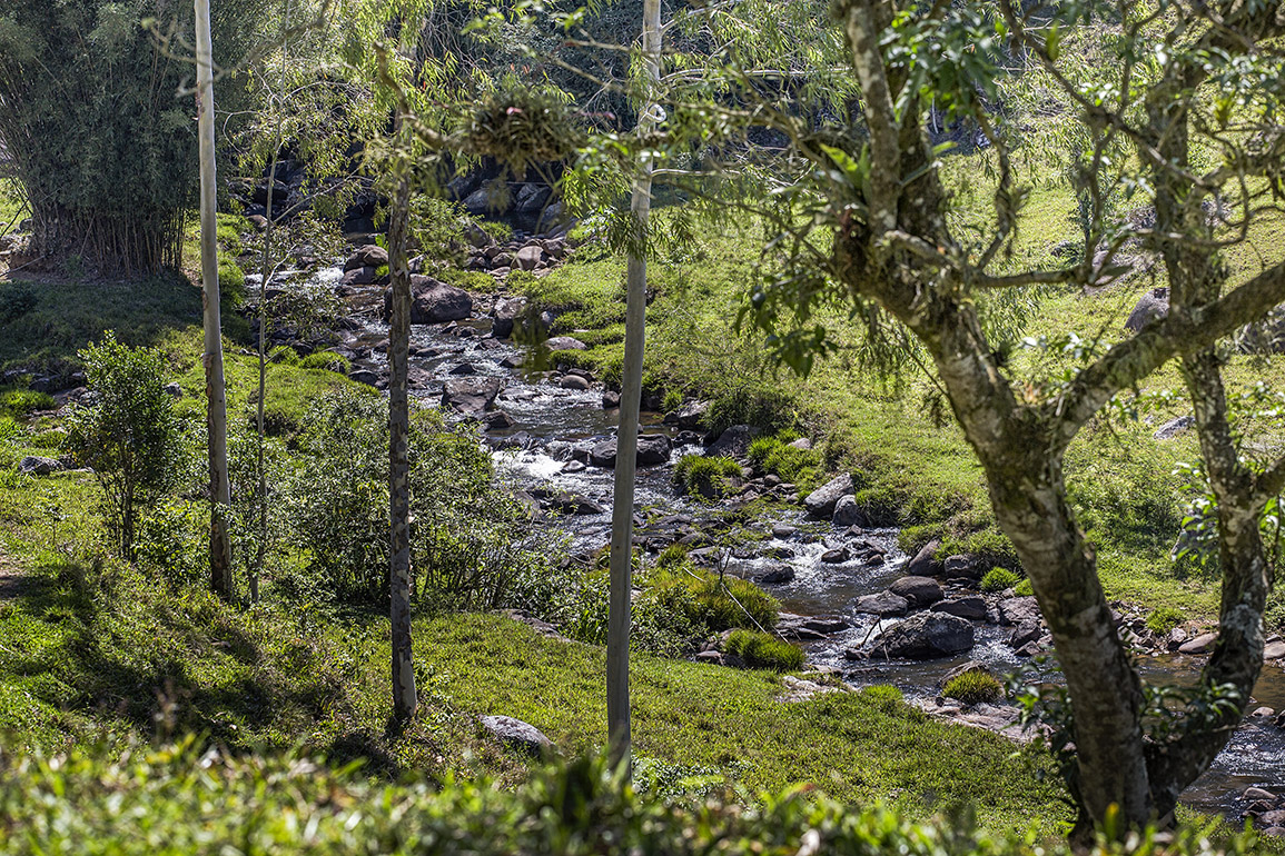
Title: Cubatão river
Description: Downstream in the region of Caldas da Imperatriz toward the centre of Santo Amaro da Imperatriz.
Local: Santo Amaro da Imperatriz, Brazil
Date of Registration: 07/09/2017

Title: Salto waterfall
Description: City centre
Local: São Pedro de Alcântara, Brazil
Date of Registration: 25/11/2012

Title: Drops at furnas
Description: Located next to BR 101 highway, these furnas are caves that in the past were shelters of Indians. The largest of them is 17 meters wide. Between the 1940s and 1950s they were places where the mooliters stopped. They are now visited by tourists who appreciate their beauties and also use them as a place of devotion and faith.
Local: Sombrio, Brazil
Date of Registration: 23/12/2015

Title: Gi beach
Description: Gi beach seen from Laguna Tourist Hotel.
Local: Laguna, Brazil
Date of Registration: 03/11/2006

Title: Sunset in São Joaquim city
Description:
Local: São Joaquim, Brazil
Date of Registration: 21/10/2012

Title: Tubarão river
Description: In the region of the bridge between the municipalities of Pedras Grandes and Orleans.
Local: Orleans, Brazil
Date of Registration: 26/12/2016

Title: Mangrove
Description: Mangrove located in the Itacorubi neighborhood.
Local: Florianópolis, Brazil
Date of Registration: 17/01/2014

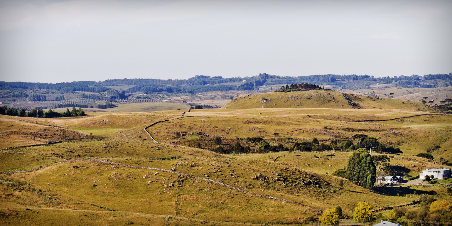
Title: Landscape of the region
Description: Mountains around the city
Local: Nova Veneza, Brazil
Date of Registration: 13/08/2011

Title: Tamborete beach
Description: It is situated between the South jetties and the Atalaia hill, in the locality of Ponta da Barra. According to the locals the name 'Tamborete' (a kind of tambourine, in Portuguese) is due to the number of similar stones with drums that exist in this beach. In 1839 in this region occurred the battle between the imperialists and farroupilhas in the historic episode of Laguna Republic.
Local: Laguna, Brazil
Date of Registration: 07/02/2015

Title: Salto waterfall
Description: City centre
Local: São Pedro de Alcântara, Brazil
Date of Registration: 23/10/2010

Title: Buildings
Description: Barra da Lagoa channel.
Local: Florianópolis, Brazil
Date of Registration: 24/08/2016

Title: Rice field
Description: Landscape of a rice field in the rural area of the city.
Local: Turvo, Brazil
Date of Registration: 12/01/2017

Title: Silo
Description: Rural area of the city.
Local: Ermo, Brazil
Date of Registration: 12/01/2017

Title: Tubarão river
Description: During the colonization period south of Santa Catarina, the pathway near the Tubarão river that was already used by the muleteers that traveled between Laguna and mountains, also began to be used by the Italian immigrants for the travel towards the colonies. Currently this route coincides largely with parts of the SC 390 highway.
Local: Orleans, Brazil
Date of Registration: 26/12/2016

Title: Landscape
Description: Plowed soil and vegetation typical of the region
Local: Nova Veneza, Brazil
Date of Registration: 13/08/2011

Title: Panoramic view from Our Lady of Aparecida belvedere
Description: It is located at 1350 meters above sea level, on the highest mountain in the region.
Local: Arroio Trinta, Brazil
Date of Registration: 29/10/2016

Title: Rio do Rastro mountain range
Description: In the extension of SC 390 highway between the cities of Lauro Müller and Bom Jardim da Serra there is the interconnection of the coastal region and the plains of the south of the State with the plateau of Santa Catarina. There are 15 kilometers of concrete road excavated in natural rock by a canyon of 1460 meters high. The history of this road began as of 1870 with the passage of muleteers mounted on mules and horses that made exchange between products of the mountain region and the coast.
Local: Lauro Müller, Brazil
Date of Registration: 21/10/2012
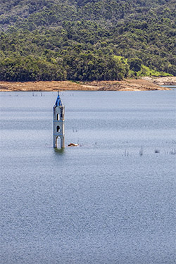
Title: São Bento river dam
Description: This dam is the main source of water for water supply integrated system to the Carboniferous Region of southern Santa Catarina: approximately 730 thousand inhabitants. It was inaugurated on 06/24/2006 and was designed to solve the permanent problem of water shortage in these cities. It is located in São Pedro village and was renamed Egídio Amboni in accordance with State Law No. 11,918 of 09/26/2001. Into its lake are the ruins of the Saint Peter Church that had been built in 1959. Its tower can still be seen mainly in periods of drought when the level of the lake is reduced. The last Mass celebrated in this Church was on 04/21/2002.
Local: Siderópolis, Brazil
Date of Registration: 23/12/2012

Title: Furnas
Description: Located next to BR 101 highway, these furnas are caves that in the past were shelters of Indians. The largest of them is 17 meters wide. Between the 1940s and 1950s they were places where the mooliters stopped. They are now visited by tourists who appreciate their beauties and also use them as a place of devotion and faith.
Local: Sombrio, Brazil
Date of Registration: 23/12/2015

Title: Salto waterfall
Description: City centre
Local: São Pedro de Alcântara, Brazil
Date of Registration: 23/10/2010

Title: Tubarão river
Description: During the colonization period south of Santa Catarina, the pathway near the Tubarão river that was already used by the muleteers that traveled between Laguna and mountains, also began to be used by the Italian immigrants for the travel towards the colonies. Currently this route coincides largely with parts of the SC 390 highway.
Local: Orleans, Brazil
Date of Registration: 26/12/2016

Title: Old Man’s Beard
Description: The lichen known as the "old man’s beard" (Usnea barbata) is abundant in the centuries-old fig trees of the region.
Local: Grão Pará, Brazil
Date of Registration: 14/01/2017

Title: Pequeno river
Description: Central region of the city.
Local: Grão Pará, Brazil
Date of Registration: 14/01/2017

Title: Mãe Luzia River in city centre (upstream)
Description: This river belongs to the watershed of the Araranguá river, and has its name referenced to a lady named (mother) Luzia, who washed clothes in the waters near the city of Nova Veneza. Unfortunately the river still suffers from pollution problems due to releases of tailings from coal mining in the region.
Local: Nova Veneza, Brazil
Date of Registration: 17/05/2014

Title: Geral Mountains
Description: View of the Geral Mountains from the city of Criciúma
Local: Criciúma, Brazil
Date of Registration: 05/08/2013

Title: Smoke oven
Description: Located next to SC 475 highway.
Local: Grão Pará, Brazil
Date of Registration: 14/01/2017

Title: Waterfall
Description: Costa da Lagoa neighborhood
Local: Florianópolis, Brazil
Date of Registration: 01/10/2011

Title: Mãe Luzia River in city centre (downstream)
Description: This river belongs to the watershed of the Araranguá river, and has its name referenced to a lady named (mother) Luzia, who washed clothes in the waters near the city of Nova Veneza. Unfortunately the river still suffers from pollution problems due to releases of tailings from coal mining in the region.
Local: Nova Veneza, Brazil
Date of Registration: 17/05/2014

Title: Mole beach
Description: Panoramic view of Mole beach, and behind the Galheta beach
Local: Florianópolis, Brazil
Date of Registration: 13/11/2010

Title: Trinta river
Description: A scenario of great beauty.
Local: Arroio Trinta, Brazil
Date of Registration: 29/10/2016

Title: Big stones hill
Description: Embedded on a hill at the entrance of the city there is a huge stone, which according to the oldest inhabitants, extends itself under the river. It is said that this big stone served as reference point for muleteers and Italian immigrants during the period of colonization of the south of Santa Catarina, and for this reason ended up giving its name to the city of Pedras Grandes (in Portuguese: big stones).
Research Source: Carneiro, Márcio Matos; Origem dos Nomes dos Municípios de Santa Catarina" - Blumenau : Nova letra, 2006.
Local: Pedras Grandes, Brazil
Date of Registration: 26/12/2016

Title: Houses of the mountains region
Description: Located near the SC 430 highway
Local: São Joaquim, Brazil
Date of Registration: 06/04/2012

Title: Bucolic scenery
Description: Outside town
Local: Águas Mornas, Brazil
Date of Registration: 11/02/2012

Title: Sunset
Description: Sunset in Treze Tílias
Local: Treze Tílias, Brazil
Date of Registration: 13/10/2012

Title: Rice field
Description: Landscape of a rice field in the rural area of the city.
Local: Turvo, Brazil
Date of Registration: 12/01/2017

Title: Panoramic view of Gravatá beach
Description:
Local: Florianópolis, Brazil
Date of Registration: 13/11/2010

Title: Coastal vegetation
Description: Localidade de Ilhas
Local: Araranguá, Brazil
Date of Registration: 12/01/2017